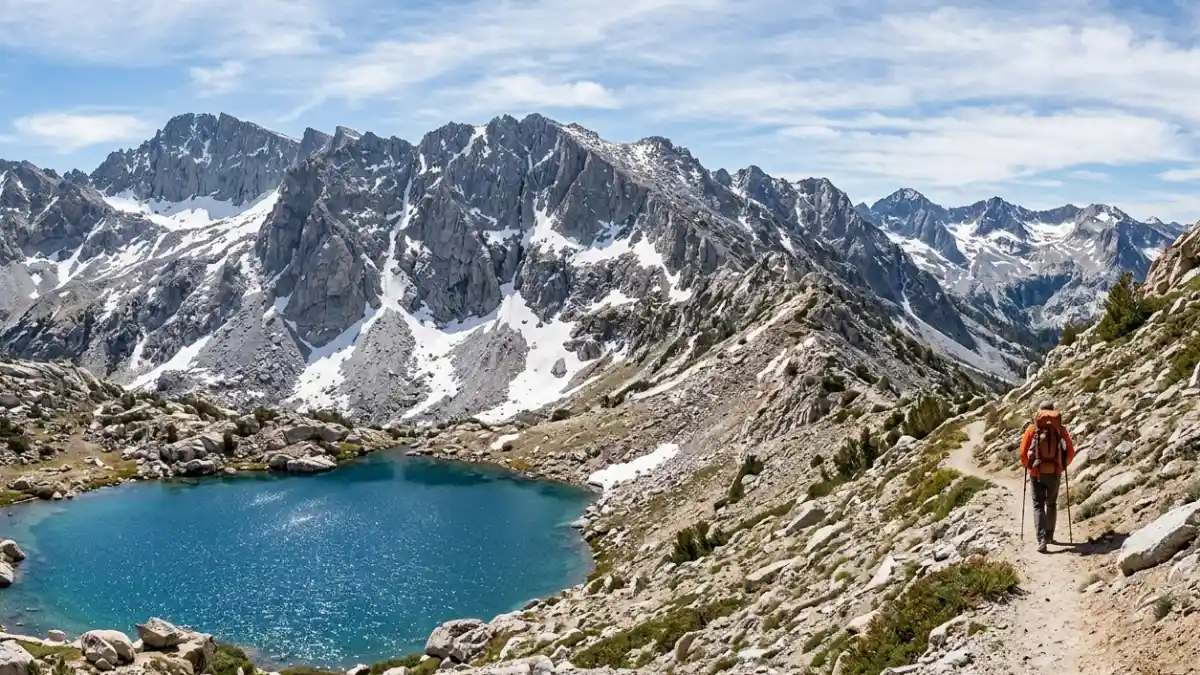
The Pacific Crest Trail (PCT) is one of the most iconic long-distance hiking routes in the world. The Pacific Crest Trail stretches 2,653 miles from the Mexican border at Campo, California, to the Canadian border at Manning Park, British Columbia. It crosses 3 states, 25 national forests, and 7 national parks.
Most thru-hikers on the Pacific Crest Trail complete the journey in 5 to 6 months, while section hikers can explore individual segments in a few days to several weeks.
There is a moment somewhere in the high Sierra of the Pacific Crest Trail, above 12,000 feet with nothing but granite and sky in every direction, when the trail stops feeling like a hiking route and starts feeling like a different way of living.
That moment is why over 6,000 people attempt a Pacific Crest Trail thru-hike every year, and why millions more dream about it.
But the Pacific Crest Trail is not a walk in the park. It crosses scorching Mojave desert, volatile Cascade volcanoes, and snow-buried mountain passes.
Poor planning kills Pacific Crest Trail trips faster than sore feet. Whether you want to walk all 2,653 miles of the Pacific Crest Trail or spend a long weekend on a cherry picked section in Oregon, preparation is everything.
This guide gives you everything that actually matters: permit requirements, best sections for every type of traveler on the Pacific Crest Trail, gear realities, resupply logistics, and the honest truths that most guides skip.
The Pacific Crest Trail Association (PCTA) manages the trail in partnership with the U.S. Forest Service and the National Park Service.
Understanding how these agencies manage the Pacific Crest Trail will save you real headaches before your first step.
Quick Facts: PCT at a Glance
| Detail | Info |
| Total Length | 2,653 miles |
| States Covered | California, Oregon, Washington |
| Southern Terminus | Campo, CA (Mexican border) |
| Northern Terminus | Manning Park, BC, Canada |
| Typical Thru Hike Duration | 5–6 months (NOBO: April–September) |
| Elevation Range | 180 ft (near Cascade Locks, OR) to 13,153 ft (Forester Pass, CA) |
| Annual Permit Quota (NOBO) | ~50 starts per day at Campo (March 1–May 31) |
| Permit Authority | PCTA (pcta.org) |
| Trail Sections | Southern CA, Central CA (Sierra), Northern CA, Oregon, Washington |
| Water Sources | Seasonal filter required (Sawyer Squeeze or Katadyn BeFree popular) |
Best Time to Hike the PCT
The ideal hiking window depends entirely on which section you plan to hike. Timing the PCT wrong is one of the most common and costly mistakes first time visitors make.
Thru hikers heading northbound (NOBO) typically start at the southern terminus between late March and late April.
Starting too early means brutally cold desert nights and minimal water in Southern California. Starting too late pushes you into the Sierra Nevada snowpack before it has melted enough to cross safely and into the Cascade fire season in late summer.
Section hikers have more flexibility. The Oregon sections (such as Crater Lake to the Columbia River Gorge) are snow free and gorgeous from late June through September.
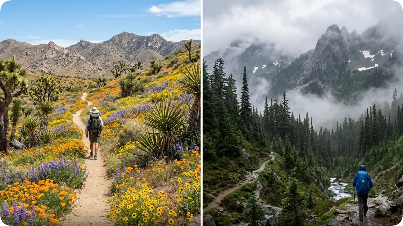
Washington’s North Cascades require extra caution, since high passes near Glacier Peak Wilderness stay snowy well into July and can see early September snowfall. Southern California’s desert sections near Anza Borrego and the Mojave are best hiked in spring (March to May) before triple digit heat makes water carries dangerous.
Seasonal Comparison
| Season | Section | Conditions | Best For |
| March–May | Southern CA (Campo to Tehachapi) | Warm days, cold nights, wildflowers | Thru hike starts, desert section hiking |
| June–July | Sierra Nevada (Kennedy Meadows to Tuolumne) | Snow on passes, peak wildflowers | Experienced mountaineers, late start thru hikers |
| July–August | Oregon (Ashland to Cascade Locks) | Dry, clear, ideal temps | Section hikers, first timers, families |
| August–September | Washington (White Pass to Manning Park) | Short window, moody skies | North Cascades devotees, fall color seekers |
| October+ | Any | Snow, closures, fire aftermath | Not recommended for most hikers |
How to Get a PCT Permit
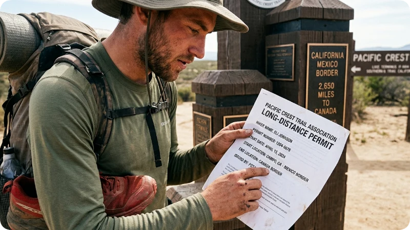
Every PCT thru hiker and most section hikers need a free long distance permit from the PCTA. Without one, rangers near the southern terminus can turn you away and have.
The PCTA issues long distance permits for anyone hiking 500+ consecutive miles. These permits allow entry into wilderness areas along the trail that would otherwise require individual permits from each land management agency. Importantly, a PCTA long distance permit does not replace the separate permit required to enter Yosemite National Park as part of the Sierra section you must still secure a Yosemite wilderness permit through recreation.gov for that stretch.
Section hikers covering fewer than 500 miles should check with each relevant national forest or national park directly, since rules vary. The Inyo National Forest, Sequoia and Kings Canyon National Parks, and Mount Rainier National Park each have their own entry requirements. Always verify permit rules at pcta.org before your trip, since quotas and application windows change annually.
Insider Tip 1: The PCTA opens its NOBO thru hike permit lottery in November each year for the following season. Apply the moment it opens. Spots fill within days, and late applicants often end up with undesirable start dates.
The 5 Best PCT Sections for Different Travelers
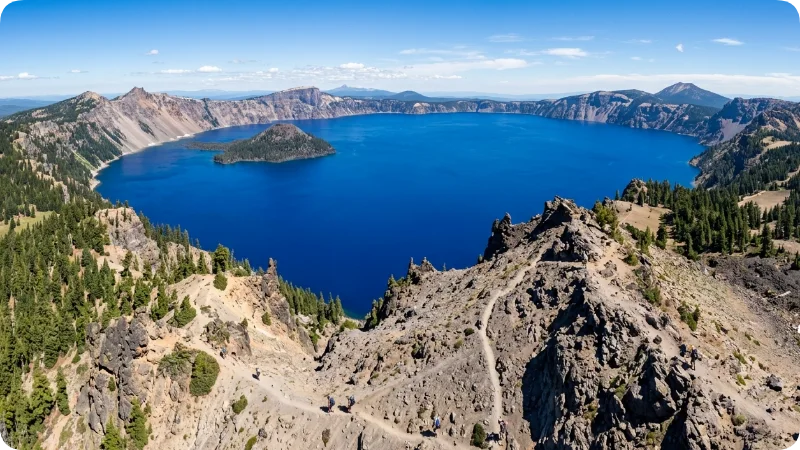
The Pacific Crest Trail (PCT) is often experienced as five distinct regions, each offering very different terrain, challenges, and rewards, so choosing the right section matters based on your skill level and goals.
The Desert Section in Southern California (Miles 0 702) runs from Campo through Anza Borrego, the San Jacinto Mountains, and the Mojave Desert to Tehachapi. It demands strong water planning, with 20 30 mile stretches between sources common in late spring. In return, hikers enjoy wide-open solitude, star-filled skies, and long, meditative desert miles.
The Sierra Nevada (Miles 702 1,092), from Kennedy Meadows North to Tuolumne Meadows, is the most iconic and challenging section. It includes high alpine terrain, nine passes above 11,000 feet, and Forester Pass at 13,153 feet the highest point on the PCT. It also crosses Sequoia, Kings Canyon, and John Muir Wilderness, and is where many hikers struggle due to snow and altitude.
Northern California (Miles 1,092 1,652) stretches to the Oregon border and is often overlooked. It passes through places like the Marble Mountains, Trinity Alps, and Lassen Volcanic National Park, offering quiet, scenic beauty that many thru-hikers rush past.
Oregon (Miles 1,652 1,987) is the most beginner-friendly section, with gentler elevation changes and reliable water sources. Highlights include Crater Lake National Park and the Three Sisters Wilderness, plus easy resupply towns like Ashland and Sisters.
Washington (Miles 1,987 2,653) is rugged and dramatic, featuring the Columbia River Gorge, Goat Rocks Wilderness, Mount Rainier’s slopes, and the North Cascades. The Goat Rocks ridgeline, with sweeping views toward Rainier, is often considered one of the most stunning days on the entire trail.
Insider Tips for the PCT
Insider Tip 2: Carry an extra day of food through the Sierra every single time, regardless of your resupply plan. Wildfires, flash floods, and injury can strand you between resupply points for far longer than expected.
Insider Tip 3: The town of Idyllwild, California is one of the PCT’s most beloved trail towns, but it sits several miles off route. Most hikers hitch from the Highway 74 junction. The Idyllwild Inn and the town’s gear shop are worth the detour, especially if you need to adjust your kit after the first 150 miles revealed what you packed wrong.
Insider Tip 4: In Oregon, the water situation reverses from California sources become almost too plentiful in some sections, and many hikers let their guard down and stop filtering. Always filter. Giardia is present throughout the trail and has no respect for crystal clear mountain streams.
Insider Tip 5: Use the Guthook Guides app (now called FarOut) for real time water source reports and hiker to hiker notes. The PCTA’s official maps are excellent for planning, but FarOut’s crowd sourced conditions updates are invaluable on the ground, especially in drought years when listed water sources dry up unexpectedly.
PCT Resupply Strategy: How to Eat for 2,600 Miles
Resupply is one of the most complex logistics problems on the PCT, and getting it wrong leads to either carrying far too much food weight or running dangerously low between towns.
Most thru hikers combine two strategies: mailing boxes to post offices and hiker friendly hostels in remote trail towns, and shopping at grocery stores in larger towns along the route. The mail drop strategy works best for specialized dietary needs and sections with very limited resupply options, such as the stretch between Kennedy Meadows and Mammoth Lakes in the Sierra. General resupply from grocery stores in towns like South Lake Tahoe, Ashland, and Snoqualmie Pass works well for hikers who can be flexible.
Key resupply towns with post office services include Big Bear City, Tehachapi, Mammoth Lakes, South Lake Tahoe, Truckee, Ashland, Bend (via Sisters), Snoqualmie Pass, and Stehekin. Stehekin in Washington deserves special mention it is accessible only by ferry or floatplane on Lake Chelan and has a beloved bakery that produces cinnamon rolls the size of your face. Plan your resupply box timing around the seasonal ferry schedule, available at ladrecreation.com.
3 Hidden Gems on the PCT
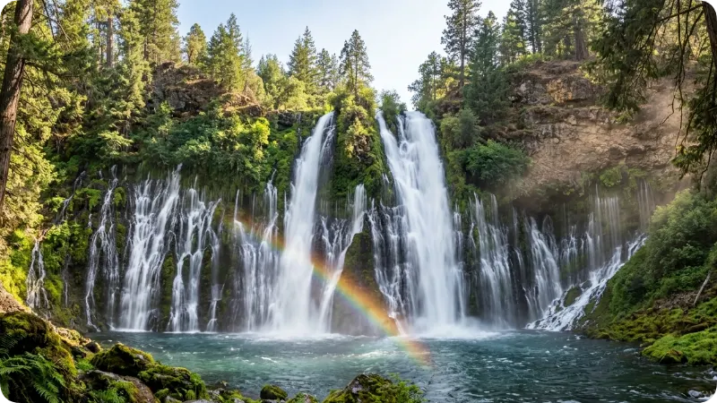
Hidden Gem 1 Burney Falls, Northern California (Mile ~1,411): McArthur Burney Falls Memorial State Park sits just a mile off the PCT and contains one of California’s most beautiful waterfalls. The 129 foot falls run year round fed by underground springs, and most PCT hikers walk right past the junction without knowing it exists. Theodore Roosevelt reportedly called it the eighth wonder of the world. Pack your towel.
Hidden Gem 2 The Packwood Glacier Viewpoint, Washington (near Mile ~2,282): Most hikers move quickly through the Mount Rainier corridor, focused on Rainier’s bulk. But a short detour above the main trail corridor near Packwood delivers glacier views with almost no other visitors. The approach involves a brief off trail scramble and rewards hikers with a perspective that the main trail never offers.
Hidden Gem 3 Kearsarge Pass, Sierra Nevada (Side Trail near Mile ~789): Technically a side trail off the PCT, the Kearsarge Pass route over to Onion Valley and the town of Independence offers the most stunning and least crowded access into the heart of the Kings Canyon backcountry. Section hikers who approach from the Independence side can design a loop through Rae Lakes arguably the most beautiful basin in the entire Sierra Nevada that most thru hikers never get to experience properly.
PCT Gear: What You Actually Need
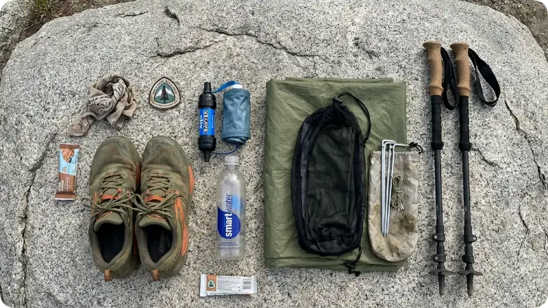
The PCT demands lightweight, weather ready gear across wildly different climates. A complete gear list from Campo to Canada could fill its own article, but these are the categories where decisions matter most.
Shelter: A three season tent or a quality tarp/bivy system works for most of the trail. However, the Sierra and the North Cascades both demand full storm protection. The Big Agnes Copper Spur series and the Zpacks Duplex have cult followings among PCT hikers for good reason they balance weight against genuine weather protection.
Footwear: Most PCT thru hikers go through three to five pairs of trail runners over the course of the hike. Hoka Speedgoat and Altra Lone Peak are perennial favorites. Heavy leather boots are increasingly rare on the trail the distance destroys ankle joints, and trail runners dry faster after water crossings. Waterproof shoes are debated endlessly: most hikers find that Gore Tex trail runners stay wet longer once they are wet, which makes them a poor choice for the wet sections of Washington in particular.
Water Treatment: A squeeze filter (Sawyer Squeeze or Katadyn BeFree) is the PCT standard. Carry a backup chemical treatment (Aquatabs or Aquamira) for emergencies. The Sierra’s glacial melt looks pristine but carries giardia and cryptosporidium treat every source without exception.
Navigation: Download offline maps on Gaia GPS or FarOut before each section. Cell service is completely absent in large stretches of the Sierra and the North Cascades. A Garmin inReach Mini satellite communicator is strongly recommended for solo hikers it allows two way messaging and SOS capability anywhere on earth.
3 Common PCT Mistakes and How to Fix Them
Mistake 1 Starting too heavy: The average first time long distance hiker starts with a base pack weight of 20 to 30 pounds. Most experienced PCT hikers carry a base weight of 10 to 15 pounds. Every pound you carry costs energy across 2,653 miles that math compounds fast. Fix: Weigh every item before your trip using a postage scale. Use lighterpack.com to audit your gear list against PCT veterans’ published lists. Cut ruthlessly before your start date, not at mile 200.
Mistake 2 Underestimating the Sierra snowpack: Most years, the Sierra Nevada carries significant snow through June, and in heavy snow years (like 2023, when the snowpack reached 300% of normal), passes remain dangerous well into July. Hikers without ice axe and crampon experience have been seriously injured on steep snow crossings near Forester and Mather passes. Fix: Check the PCTA’s weekly trail conditions reports beginning in March. Be prepared to flip north to Oregon and return to the Sierra later if snow levels are dangerous when you arrive.
Mistake 3 Skipping town zeros: A “zero day” is a rest day with zero trail miles. Many first time PCT hikers push relentlessly through the first month and wonder why their knees, tendons, and morale collapse around mile 300. Fix: Plan at least one zero day every week or week and a half during the first month. Your connective tissue needs more recovery time than your cardiovascular system, and ignoring that reality is the single most common reason hikers leave the trail early.
3 Underrated Alternatives to the Full PCT Thru Hike
Alternative 1 The John Muir Trail (JMT): The JMT shares roughly 200 miles with the PCT through the best of the Sierra Nevada, from Yosemite Valley to Mount Whitney. At 211 miles, most fit hikers complete it in 18 to 24 days. It delivers the PCT’s most spectacular scenery in a fraction of the time commitment. JMT permits through Yosemite are competitive apply through recreation.gov in February for summer departures.
Alternative 2 Oregon PCT Section (Ashland to Cascade Locks, ~430 miles): Oregon’s PCT section offers the most accessible long distance hiking experience in the western United States. The terrain is gentler, the scenery is stunning, the resupply infrastructure is solid, and the three to four week completion time is manageable for people with limited vacation days. It crosses Crater Lake National Park and the Three Sisters Wilderness two of Oregon’s crown jewels.
Alternative 3 The Wonderland Trail, Washington: Encircling Mount Rainier in 93 miles, the Wonderland Trail gives hikers a focused, high quality alternative to the full Washington PCT section. Permits through Mount Rainier National Park are required and available through recreation.gov. The trail passes through old growth forest, subalpine meadows, and glacier viewpoints and the logistics are far simpler than managing a multi state thru hike.
PCT Packing Checklist
Before your first PCT trip, confirm you have covered these essentials:
Permits secured (PCTA long distance permit, Yosemite wilderness permit if applicable, JMT permit if applicable)
Navigation loaded offline (Gaia GPS or FarOut with downloaded maps)
Water treatment system tested (squeeze filter + backup chemical tabs)
Resupply boxes mailed or resupply plan confirmed
Emergency communication device charged (Garmin inReach or similar)
Bear canister packed if entering any Sierra National Park or Wilderness area requiring one (Ursack Major is PCT legal in many zones verify with the relevant land management agency)
First aid kit including blister care (leukotape, not moleskin), ibuprofen, and electrolyte tablets
Layering system appropriate for 40 degree temperature swings (desert nights are cold even in May)
Sunscreen and sun protection rated for high altitude UV exposure
Safety on the PCT: What Actually Hurts Hikers
The PCT’s biggest hazards are not mountain lions or rattlesnakes they are dehydration, hypothermia, and overuse injury. Understanding the real risks helps you prepare for them properly.
Dehydration in the Southern California desert section kills PCT hikes more reliably than any other single factor. Water carries of 25 plus miles are required in the Anza Borrego stretch and parts of the Mojave near Cajon Pass. Hikers who underestimate these carries run into serious trouble. The PCTA’s water report page (pcta.org/discover the trail/water report/) aggregates real time field reports from trail volunteers check it obsessively before entering any dry stretch.
Hypothermia is the Sierra’s primary threat. Summer thunderstorms above treeline develop with almost no warning, and afternoon temperatures near Forester and Glen passes can drop 40 degrees in an hour. A quality waterproof shell packed in an accessible location not buried at the bottom of your pack is not optional in the high country.
The CDC recommends hikers on the PCT be current on standard travel vaccinations and treat all backcountry water sources, since waterborne illness from protozoa is a documented risk throughout the trail’s length.
Frequently Asked Questions About the PCT
Do I need a permit to hike the PCT?
Yes. Anyone hiking 500 or more continuous miles needs a free PCTA long distance permit. Section hikers covering less than 500 miles need to check individual wilderness and national park permit requirements for each stretch they plan to hike. Some areas particularly in the Sierra Nevada have strict overnight quotas and require advance reservations through recreation.gov. Always verify current requirements at pcta.org before your trip.
How much does a PCT thru hike cost?
Most thru hikers spend between $5,000 and $10,000 for the full 2,653 mile journey, including gear, food, transportation, and incidentals. Budget hikers who mail resupply boxes, cook their own food, and camp consistently tend toward the lower end. Hikers who stay in hotels, eat in restaurants, and resupply from expensive trail town stores can spend considerably more. Budget at least $1.00 to $1.50 per mile for food alone.
What is the hardest section of the PCT?
The Sierra Nevada section from Kennedy Meadows North to Tuolumne Meadows is consistently rated the most physically demanding, particularly in high snow years. The combination of high passes, snow crossings, river fords, and remote terrain with limited exit options makes it technically and physically challenging. Washington’s North Cascades near Glacier Peak Wilderness run a close second due to extreme remoteness, challenging weather, and aggressive elevation changes.
Can beginners hike the PCT?
Section hiking the PCT is accessible to fit beginners with proper preparation. Oregon’s PCT section in particular is an excellent starting point for long distance hiking newcomers. A full thru hike is not recommended as a first long distance hiking experience the Sierra Nevada and North Cascades require navigation and mountaineering skills that take time to develop. Build up with 50 to 100 mile section hikes first.
When should I apply for a PCT permit?
NOBO thru hike permits open in a lottery each November for the following hiking season. Applications typically open November 1 and close November 30, with results released in December. Section hiker permits for specific wilderness areas (Yosemite, Inyo, Sequoia Kings Canyon) have separate application windows. Check recreation.gov and pcta.org for current year dates, as schedules shift slightly each year.
Is the PCT safe to hike solo?
Yes, with appropriate preparation. Solo hiking the PCT is extremely common a significant percentage of thru hikers hike alone for portions or all of the journey. The trail’s strong community culture means solo hikers rarely feel truly isolated. Key solo hiker safety measures: carry a satellite communicator, share your itinerary with a trusted contact at home, know your limits in the Sierra and North Cascades, and never let trail pressure push you across a dangerous snow pass alone.
What wildlife should PCT hikers watch out for?
Black bears are common throughout the Sierra Nevada and require bear canisters or approved bear resistant containers in many wilderness zones this is not optional and rangers do cite hikers. Rattlesnakes are prevalent in Southern California’s desert section but rarely aggressive. Mountain lions exist throughout the trail but encounters are extremely rare. The U.S. Fish and Wildlife Service notes that most PCT wildlife incidents involve improper food storage rather than unprovoked animal aggression. Never leave food unattended and always hang or canister your food properly.
Conclusion: Is the PCT Worth It?
Three things will stay with you long after your PCT miles are behind you: the scale of the landscape, the simplicity of a life measured in miles and calories, and the community of strangers who become, over weeks and months on trail, something much closer to family.
If you hike five miles or 2,653, the Pacific Crest Trail delivers an experience unavailable in any other form.
Oregon’s section gives first timers a genuine taste with manageable commitment. The Sierra tests and transforms hikers willing to put in the work.
The North Cascades hand the trail its most dramatic final chapter.
Start with a section that matches your current fitness and skills. Build experience deliberately.
When you are ready for the full trail, you will know it and you will be prepared for it in a way that makes the difference between finishing and quitting somewhere in the Mojave.
Check current permit availability and trail conditions at pcta.org before booking any travel, and verify all fees and park entry requirements directly with the relevant land management agencies, as these change regularly.

Ben Fogle believes that true adventure begins where the pavement ends. After spending years documenting extreme environments, rowing across oceans, and trekking through frozen landscapes, he mastered the art of wilderness travel. For Travelmarse, Ben constructs highly detailed guides on deep-nature packing lists, wildlife safety, and sustainable eco-tourism. He breaks down intimidating, rugged expeditions into clear, step-by-step roadmaps so everyday travelers can safely connect with the natural world.